In my research, I have had the pleasure of focusing many projects in the area located on the border between Minnesota and Ontario near the general region of Rainy Lake. This area is part of the Superior Province, the world’s largest contiguous Archean granite-greenstone terrane. The tectonic history of this area (one version of it) began approximately 2.7 billion years ago when a series of volcanic island arcs collided into one another creating a classic Archean granite-greenstone terrane. Between two of these island arc subprovinces, the Wawa and the Wabigoon, lie the Quetico metasediments that were probably deformed during the collision.
At this boundary between the Quetico and Wabigoon subprovinces, the rocks have undergone a prolonged history of deformation. The rocks at the boundary have undergone ductile deformation as evidenced by their prominent foliation and lineation mineral fabrics. Two major shear zones, the Seine River- Rainy Lake and the Quetico, localize deformation.
Hop on the bus to any of the stops below:
Seine River Conglomerates: ***The World’s Prettiest Rocks: Check these out first!***
The Seine River conglomerates are the featured attraction of the field area. They formed approximately 2.7 billion years ago along the boundary between the Quetico and Wabigoon subprovinces. They were beautifully deformed.
-

- Shear sense indicators to warm the heart of structural geology enthusiasts. The sigma shapes of the deformed pebbles suggest dextral shear sense. This is a typical subhorizontal surface.
-

- Often, the conglomerates have so many clasts they interact in interesting ways during deformation.
-

- A granitoid clast behaves more rigidly than the surrounding rock and rotates.
-

- Some primary sedimentary features still exist. Here is an example of bedding as can be seen by the thick dark layer of finer, sandy sediment.
All of these pictures are taken on subhorizontal surface. Wouldn’t you like to see a 3D view of the conglomerates so you can see that they are flattened?
By looking at the conglomerates from all sides, we can see that they have been extremely flattened into pancake-like shapes. These photos show conglomerate clasts that are cut in 3, approximately perpendicular, sections. In these pictures, the blue dots are 5 cm across, and the masking tape line is oriented along the strike of the surface (horizontal).
-

- Most of the rocks are visible (thanks to our friends, the glaciers, that removed most of the soil) on large horizontal surfaces. You can see the conglomerate clasts here are oblong.
-

- Sometimes (especially on Ontario Highway 11 road cuts), we can see other rock surfaces. This picture shows a surface that is cut approximately parallel to the maximum stretching direction. You can see the conglomerate clasts here are extremely elongated, especially those that are gray and black (made of volcanic rock).
-

- This picture was taken parallel to the foliation. The rock is less photogenic from this orientation, but if you look carefully, you can see large clasts oriented at an angle. The clasts here display the large face of the pancake shapes.
The Ottertail Pluton
The Ottertail Pluton is part of the Algoman Suite of plutons, the youngest rocks in the area (approximately 2685 Ma).
-

- The edge of the Ottertail Pluton has inclusions of foliated country rock.
-

- Most of the pluton is massive without a distinctive fabric.
-

- There are, however, a few scattered small-scale shear zones within the pluton. Most are coated with chlorite and/or epidote.
-

- This is a photo taken under the microscope with cross-polars of a thin section of the pluton. Deformation structures, such as undulose extinction, can be seen in the quartz grains.
-

- This is a photo taken under the microscope with cross-polars of a thin section of the pluton. Deformation structures, such as recrystallized grains, can be seen in quartz.
Other Rocks
Even though the Seine River conglomerates are the star attraction of the field area, many other beautiful and interesting rocks are also great field trip stops.
-

- Associated metasedimentary rocks have nice little folds.
-

- Just to the west, the Ottertail Creek Pluton intrudes the greenschist rocks. This picture shows remnant foliated rocks mixed up in pluton material.
-

- Those big red specks are large garnets found to the north of the Seine River group. They are full of inclusions and occur near plutonic contacts.
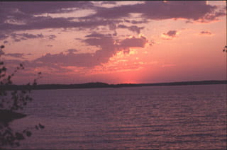
Scenic Waterways in Borderland
When you finally take your eyes off the rocks, there is plenty of other scenery in Borderland. You can enjoy all the water: lakes, rivers, swamps- thanks to our friends the glaciers.
-

- From this scene in Minnesota, we can enter Canada by road which will take us across Bear’s Pass.
-

- Or we can enter by boat up the Seine River.
-

- Either way, we can end up at Shoal Lake on a gorgeous day for canoeing.
-

- Bad Vermilion Lake, near the tiny town of Mine Centre, Ontario, is always an ideal place to camp. “Ah, Bliss!”